Administrative Division Map
Administrative Division Map
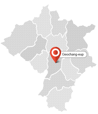
- Geochang-eup
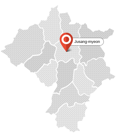
- Jusang-myeon
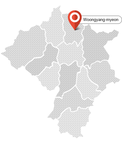
- Woongyang-myeon
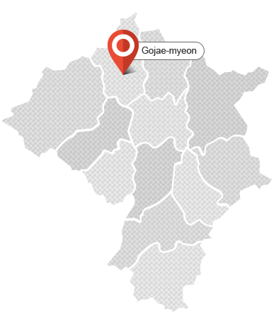
- Gojae-myeon
- Buksang-myeon
- Wicheon-myeon
- Mari-myeon
- Namsang-myeon
- Namha-myeon
- Shinwon-myeon
- Gajo-myeon
- Gabuk-myeon
Geochang-eup
- 90 Geoyeol-ro, Geochang-eup, Geochang-gun, Gyeongsangnam-do
- Tel. +82-55-940-7220, Fax. +82-55-940-7219
Visit the Website of Geochang-eup
Jusang-myeon
- 655, Jugok-ro, Jusang-myeon, Geochang-gun, Gyeongsangnam-do, Korea
- Tel. +82-55-940-7360, Fax. +82-55-940-7359
Visit the Website of Jusang-myeon
Woongyang-myeon
- 1431, Ungyang-ro, Ungyang-myeon, Geochang-gun, Gyeongsangnam-do, Korea
- Tel. +82-55-940-7410, Fax. +82-55-940-7409
Visit the Website of Woongyang-myeon
Gojae-myeon
- 14, Ipseok 1-gil, Goje-myeon, Geochang-gun, Gyeongsangnam-do, Korea
- Tel. +82-55-940-7460, Fax. +82-55-940-7459 Visit the Website of Gojae-myeon
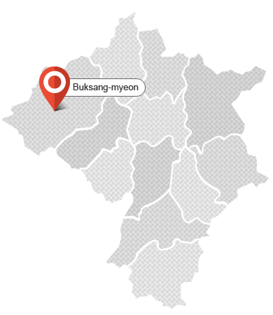
Buksang-myeon
- 710, Songgye-ro, Buksang-myeon, Geochang-gun, Gyeongsangnam-do, Korea
- Tel. +82-55-940-7510, Fax. +82-55-940-7509
Visit the Website of Buksang-myeon
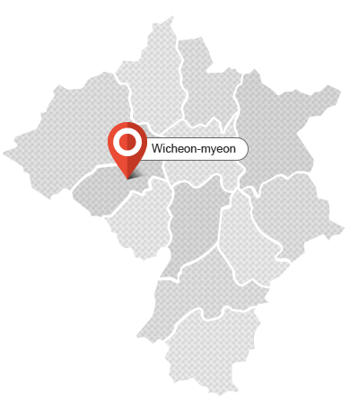
Wicheon-myeon
- 324, Wonhak-gil, Wicheon-myeon, Geochang-gun, Gyeongsangnam-do, Korea
- Tel. +82-55-940-7560, Fax. +82-55-940-7559
Visit the Website of Wicheon-myeon
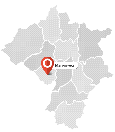
Mari-myeon
- 18, Ppaejae-ro, Mari-myeon, Geochang-gun, Gyeongsangnam-do, Korea
- Tel. +82-55-940-7610, Fax. +82-55-940-7609
Visit the Website of Mari-myeon
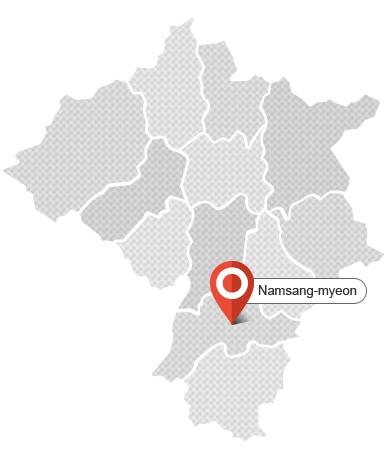
Namsang-myeon
- 36, Inpyeong-gil, Namsang-myeon, Geochang-gun, Gyeongsangnam-do, Korea
- Tel. +82-55-940-7660, Fax. +82-55-940-7659
Visit the Website of Namsang-myeon
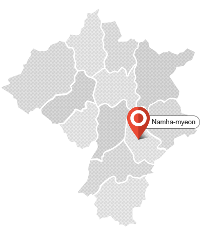
Namha-myeon
- 41, Youngseo-ro, Namha-myeon, Geochang-gun, Gyeongsangnam-do, Korea
- Tel. +82-55-940-7710, Fax. +82-55-940-7709
Visit the Website of Namha-myeon
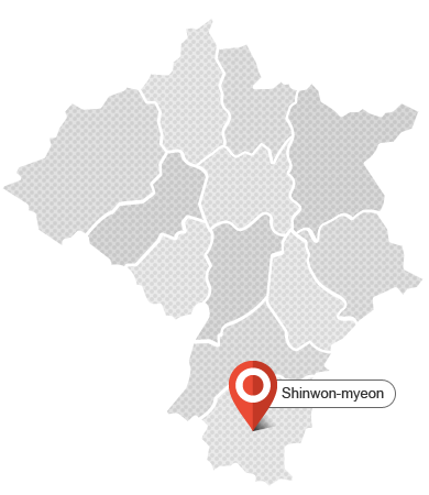
Shinwon-myeon
- 3067, Shincha-ro, Sinwon-myeon, Geochang-gun, Gyeongsangnam-do, Korea
- Tel. +82-55-940-7760, Fax. +82-55-940-7759
Visit the Website of Shinwon-myeon
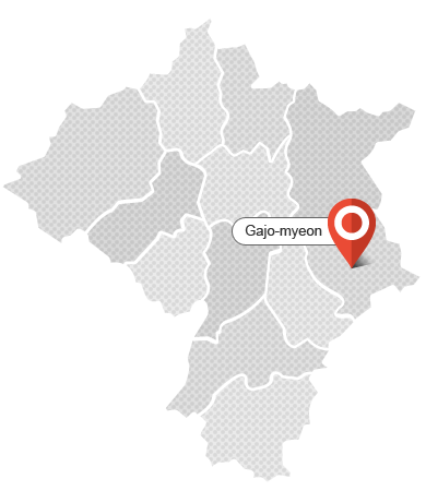
Gajo-myeon
- 8, Janggunbong 1-gil, Gajo-myeon, Geochang-gun, Gyeongsangnam-do, Korea
- Tel. +82-55-940-7810, Fax. +82-55-940-7809
Visit the Website of Gajo-myeon
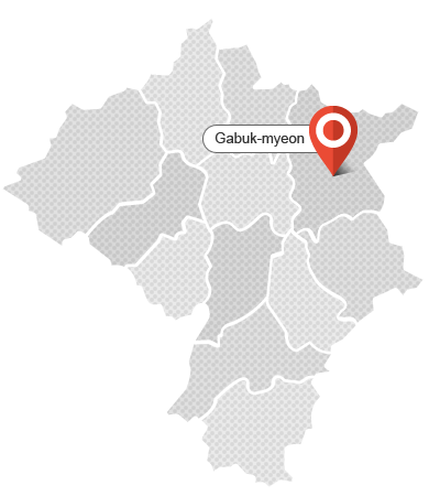
Gabuk-myeon
- 17-16, Yongam-ro, Gabuk-myeon, Geochang-gun, Gyeongsangnam-do, Korea
- Tel. +82-55-940-7860, Fax. +82-55-940-7859
Visit the Website of Gabuk-myeon
Area
| Korea | Gyeonsangnam-do | Geochang | Ratio |
|---|---|---|---|
| 100,188.08 ㎢ | 10,534.94㎢ | 803.17㎢ | 7.62%(Gyeonsangnam-do) |
Administrative Division
| Category | Area(㎢) | Ratio(%) | ri/dong | nature villages | |
|---|---|---|---|---|---|
| Administrative | Legal | ||||
| Total | 804 | 100 | 266 | 94 | 420 |
| Geochang-eup | 56 | 7 | 37 | 13 | 60 |
| Jusang-myeon | 50 | 6 | 18 | 7 | 30 |
| Woongyang-myeon | 58 | 7 | 24 | 7 | 30 |
| Gojae-myeon | 58 | 7 | 17 | 5 | 31 |
| Buksang-myeon | 125 | 16 | 12 | 7 | 26 |
| Wicheon-myeon | 54 | 7 | 19 | 7 | 32 |
| Mari-myeon | 47 | 6 | 23 | 7 | 31 |
| Namsang-myeon | 69 | 9 | 25 | 10 | 40 |
| Namha-myeon | 50 | 6 | 20 | 5 | 21 |
| Shinwon-myeon | 74 | 9 | 21 | 9 | 43 |
| Gajo-myeon | 66 | 8 | 32 | 10 | 45 |
| Gabuk-myeon | 96 | 12 | 18 | 7 | 31 |
Population by Eup and Myeon (as of May 2016.)
| Eup and Myeon | Population of the preceding month | Population (Korean) | Variation (month-on-month) | Foreigners | |||||
|---|---|---|---|---|---|---|---|---|---|
| Total | Male | Female | No. of households | Population | Total | Male | Female | ||
| Total | 27,999 | 63,177 | 30,684 | 32,493 | 58 | 50 | 476 | 222 | 254 |
| Geochang-eup | 16,366 | 40,761 | 19,985 | 20,776 | 49 | 80 | 228 | 100 | 128 |
| Jusang-myeon | 846 | 1,656 | 797 | 859 | 2 | 4 | 20 | 9 | 11 |
| Woongyang-myeon | 1,009 | 2,057 | 1,001 | 1,056 | △6 | △5 | 16 | 1 | 15 |
| Gojae-myeon | 787 | 1,526 | 757 | 769 | 2 | △1 | 8 | 2 | 6 |
| Buksang-myeon | 862 | 1,626 | 786 | 840 | 2 | △4 | 29 | 15 | 14 |
| Wicheon-myeon | 1,089 | 2,183 | 1,028 | 1,155 | 5 | 7 | 53 | 36 | 17 |
| Mari-myeon | 1,158 | 2,134 | 1,021 | 1,113 | 1 | △10 | 20 | 9 | 11 |
| Namsang-myeon | 1,312 | 2,618 | 1,249 | 1,369 | 3 | 11 | 54 | 34 | 20 |
| Namha-myeon | 836 | 1,565 | 752 | 813 | △2 | △12 | 7 | 2 | 5 |
| Shinwon-myeon | 891 | 1,619 | 777 | 842 | 4 | 3 | 25 | 8 | 17 |
| Gajo-myeon | 2,017 | 3,987 | 1,851 | 2,136 | △2 | △23 | 9 | 3 | 6 |
| Gabuk-myeon | 826 | 1,445 | 680 | 765 | 0 | 0 | 7 | 3 | 4 |
| Category | At the end of December 2015 | At the end of May 2015 (preceding year) |
At the end of April 2016 (preceding month) |
|||
|---|---|---|---|---|---|---|
| No. of households | Population | No. of households | Population | No. of households | Population | |
| Total | 27,895 | 63,232 | 27,685 | 63,034 | 27,941 | 63,139 |
| Geochang-eup | 16,275 | 40,736 | 16,135 | 40,494 | 16,317 | 40,681 |
| 11 myeons | 11,620 | 22,496 | 11,550 | 22,540 | 11,624 | 22,446 |
Factors that have Affected the Population Size
| Category | Pop. Increasing Factors | Pop. Decreasing Factors | Variation | |||
|---|---|---|---|---|---|---|
| Total | Subtotal | 493 | Subtotal | 443 | 50 | |
| Factors | Move-in | 454 | Move-out | 397 | 57 | |
| Birth | 33 | Death | 44 | △11 | ||
| Registration | 4 | Registration Cancellation | 1 | 3 | ||
| Foreign | - | Foreign | 1 | △1 | ||
| Etc | 2 | Etc | - | 2 | ||
Footer Information
Author(Contact / Copyright)
![]()
SNS


